Day 21 of C2Cx2 – Stonethwaite to Grasmere, Saturday 20 September 2014.
Statistics:
distance - 11.2 miles;
moving speed – 2.3 mph
start – 9.10 am
finish – 5.45 pm
moving – 4h 52m
The walk from Rosthwaite via Stonethwaite to Grasmere was Graham's favourite day of our 2010 C2C. Not wanting to tarnish the wonderful memories of that day, we had chosen a totally different route from Stonethwaite to Grasmere. We would follow the Cumbria Way along Langstrath and up to Stake Pass, then turn off to the summit of High Raise and along Blea Rigg as far as Blea Crag then down to Easedale Tarn and alongside Sour Milk Gill to Grasmere.
Some of our intended paths on the tops were not apparent on Google maps and could be difficult to find in mist. Graham was concerned about the weather in the morning as the clouds were down on the tops of the fells surrounding the Greenup Gill valley. The host of our B&B put the TV on in the dining room while we were having breakfast so we could see a weather report. The forecast was for a murky morning clearing at midday. We set off with fingers crossed hoping the forecast was right.
The superb view as we left Stonethwaite across green fields past a herd of Herdwick sheep was of Eagle Crag and mist covered fells. As we turned up Langstrath a red squirrel scampered along a drystone wall and up into an overhanging oak. For a little over an hour we followed the beautiful Langstrath Beck up the glacier carved U-shaped valley. We turned off from the valley floor up the Stake Pass path and stopped at 11.15 for morning tea with views back down the broad valley. As we watched, clouds rolled down from the fell tops. After our tea break, we continued along the track to Stake Pass zig-zagging up the steep valley side beside the waterfalls of Stake Beck.

'Leaving Stonethwaite, Eagle Crag ahead'

'Herdwick sheep and lambs'
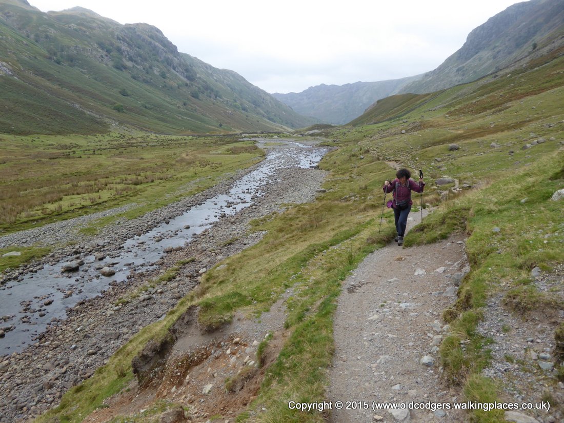
'Walking beside Langstrath Beck'
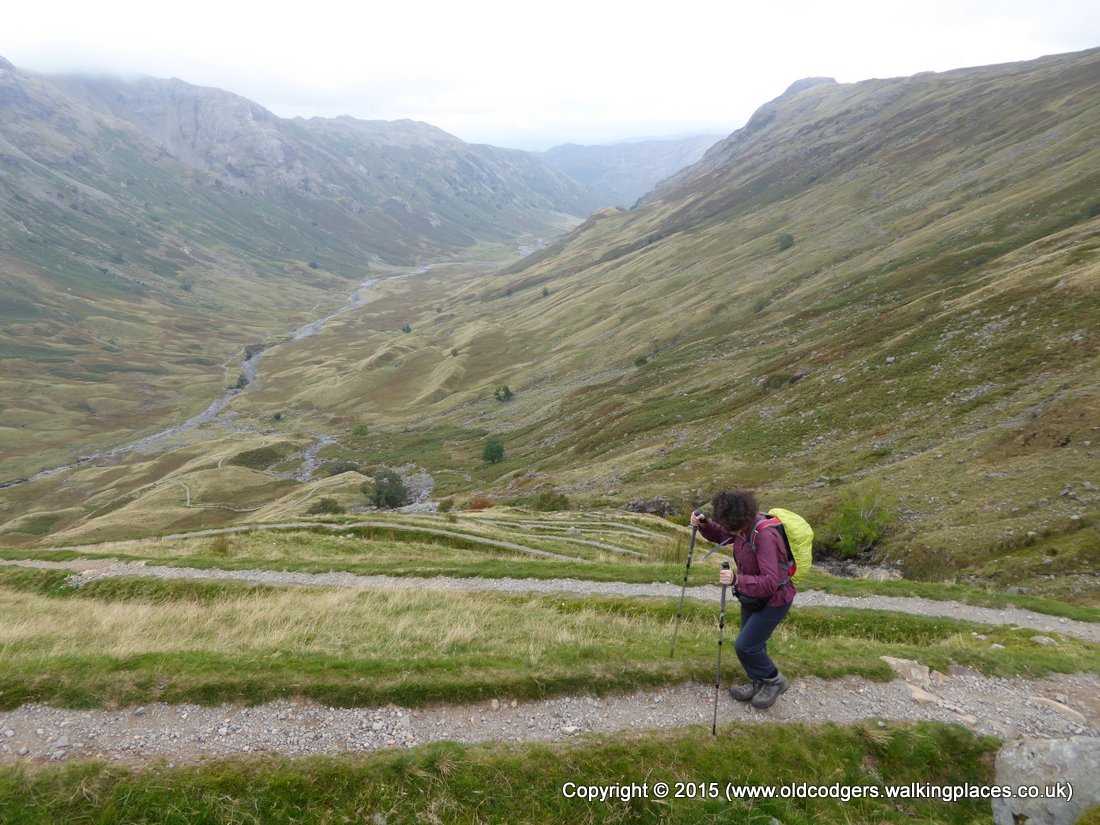
'Zig-zag path up to Stake Pass'

'Waterfall on Stake Beck'
We reached the plateau across the top of Stake Pass wondering where the path to High Raise turned off. We were doubly fortunate – firstly, the cloud hadn't descended as far as the plateau, and secondly a walker accompanied by a large blonde retriever was walking along a path on our left. We met where the paths crossed and he confirmed our suspicion that he had just come from High Raise. Had we reached this point in mist we would have had difficulty finding the faint path.

'Junction of Stake Pass path (left) and faint path to High Raise (right)'
As we began the gentle climb to High Raise we entered the clouds. Visibility varied from 10-50 metres. Fortunately the path continued roughly straight towards the summit. We were able to follow the faint path through the mist with the aid of a compass bearing and occasional GPS checks to arrive at the white rocks and summit cairn of High Raise. We had only seen one walker all morning, but on arrival at the summit we were surprised to find a dozen ghostly shapes moving around in the mist. We chatted with a couple walking a dog. They had come from Sergeant Man, our next target, and were able to point us in the right direction. They said it would be easy after Sergeant Man because we'd know if we were going in the wrong direction - we'd fall off the edge of the mountain!

'Mary enveloped by the mist'

'Ghostly shapes at the summit of High Raise'
Again, we were able to follow the faint path with the aid of a compass bearing until we came to an area near a tarn criss-crossed by paths. Using the GPS and OS map we zig-zagged our way to Sergeant Man. Here too there were many people on and around the summit. After the zig-zag trajectory in the heavy mist, Graham was disoriented and couldn't reconcile map, GPS and his idea of where we were facing. We followed a group of eight people who told us they were heading along Blea Rigg. It was only when we emerged from beneath the cloud bank to see Stickle Tarn that Graham could reconcile the map in his mind with the OS map and the reality of where we were.

'Tarn in the mist, High Raise'

'The mist lifts revealing Stickle Tarn and Pavey Ark'
A young group of walkers vacated a large flat rocky outcrop as we neared, so we stopped there for lunch. We had a grand view from Easedale Tarn around to Windermere and Loughrigg Fell where we had lunched six days ago. We didn't stop for too long because it was chilly, even with the raincoats we had put on earlier to protect us from the mist. A little further along we were rewarded with views of both Codale and Easedale Tarns.

'Lunch on Blea Rigg with a grand view –Easedale Tarn at left, Windermere on right'

'View of Codale and Easedale Tarns'
We stumbled along the multiple paths on Blea Rigg as far as Blea Crag, guided by several GPS readings, and then descended a very rough, rocky and boggy path down to Easedale Tarn. On one of the boggy sections Mary stepped onto the edge of a mossy rock hidden under the grass. She lost her footing resulting in a very wet and bruised bottom. We were very tired, emotionally and physically, by the time we reached the tarn.

'Descent from Blea Crag'

'Sour Milk Gill was just a trickle'
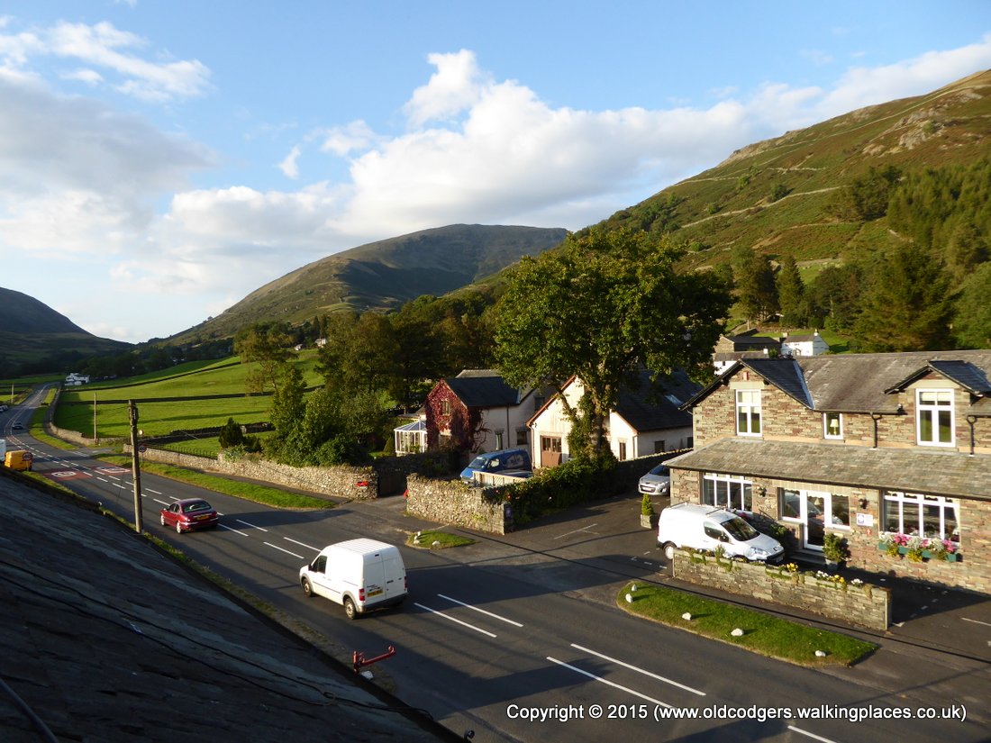
The falls on Sour Milk Gill that had so impressed Graham in 2010, and were part of the reason for taking the alternative route this time, were just a trickle after the dry weather. By the time we reached Grasmere we were tired so headed straight for our B&B. The people at Chestnut Villa had done us a favour allowing us to stay for one night when they, and most other places in Grasmere, normally require a two night booking during the weekend. Our room was as we had remembered the B&B from our previous stay – clean, bright and airy with a view over the fells we were to walk the following day. However, our bathroom was built under the eaves, and the bath required some flexibility to fold into. Graham enjoyed his bath, but Mary required assistance to fold her knees sufficiently to get in and out.

'Pretty window boxes, Grasmere'
'View from our B&B window – next morning we walked up the valley between the hill on the right and Seat Sandal in the centre'
We had a short walk to the Swan Hotel for dinner where Mary had the flashest fish, chips and mushy peas on the walk – the lemon wedge was wrapped in gauze to allow easy squeezing over the fish. Graham's Barnsley chop wasn't as good as his memory of the one in Reeth four years ago, but his Old Peculier was as good as ever.

'The Swan Hotel'

'Flash fish'n'chips'

'After a good dinner'
This day had been a real challenge. We had averaged only 2.3 miles per hour while we were moving. On the NoEW we averaged around 3 mph, except for the day of manoeuvring through the cleared forest near Boot when the average was down to 2.6 mph. It wasn't just the ups and downs of the Lake District – we averaged 2.7 mph on our day over Haystacks. Trying to follow a faint path through the mist had slowed us greatly. Had we not met people acquainted with the area at a couple of crucial points, and if the cloud cover had been a little lower, it would have been even more difficult and time-consuming finding directions. So although we only walked 11.2 miles, it was the most tiring day of the walk. Had we gone the usual C2C route we would have been on an easily followed path except for the boggy section across Greenup Edge that would have been in cloud.
Graham thought the adventure worthwhile, but recognised that we had taken a risk and could have come unstuck. Mary, who relies on Graham's navigational skills, did not enjoy the day. So we decided not to take the more challenging alternative routes Graham had selected for the next two days and to stick to the easiest of the C2C routes instead.