Day 16 of C2Cx2 – Coniston to Boot, Monday 15 September 2014.
Statistics:
distance - 12.5 miles;
moving speed – 2.6 mph
start – 10 am
finish – 5.30 pm
moving – 4h 45m
As we did our morning chores before breakfast, we admired the village from our room. The hotel manager was out watering the window baskets and pots of flowers. Graham had his usual breakfast while Mary had baked beans on toast. The pub felt warm, welcoming and laid-back, and it functioned very efficiently in an unobtrusive way. This pub was the closest Graham had found to his mental picture of an ideal English country pub. We hope it doesn't become pretentious and plastic in the way of some modern makeovers. After paying our bill the manager was happy to discuss Coniston, walking, and pub closures. We enjoyed the conversation as we weren't in a hurry – it was a shorter mileage to be walked for the day.

'Coniston village'
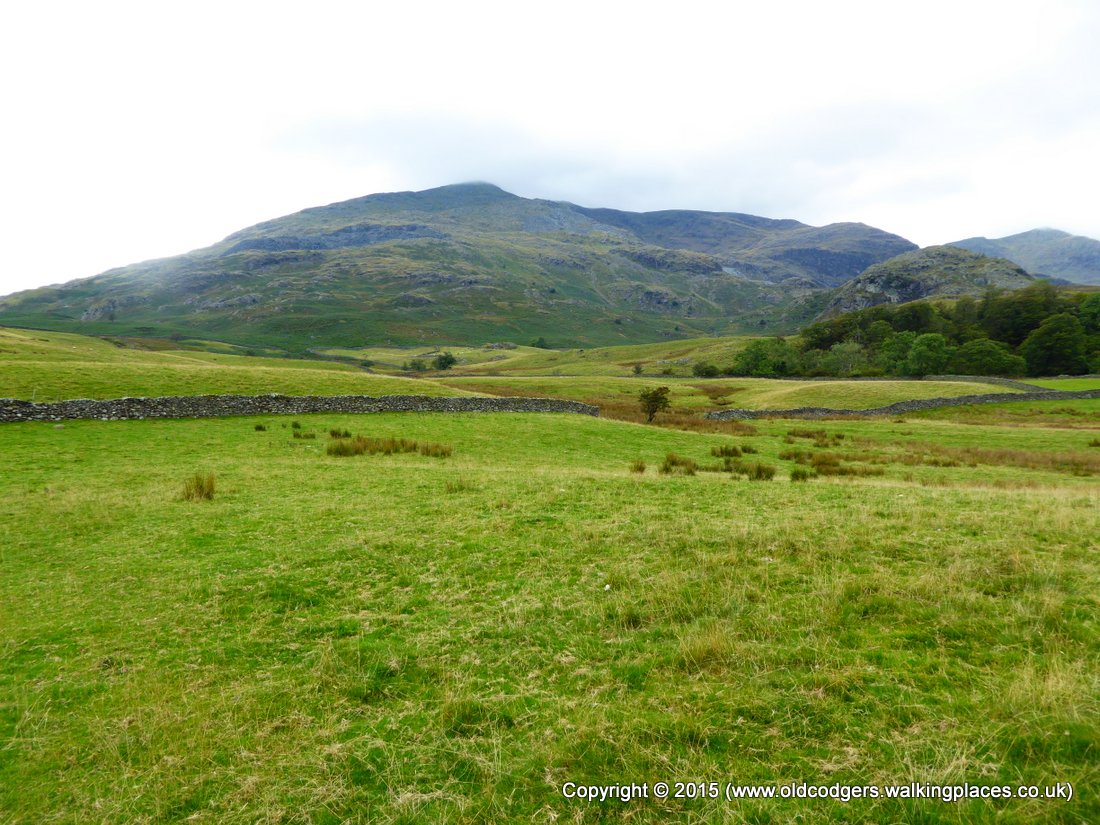
The first half mile out of Coniston was extremely steep tarmac road, followed by another half mile of not quite so steep road. The route then followed the very rocky Walna Scar Road, with Old Man of Coniston towering on the right and the Brown Pike/ White Pike ridge ahead. Initially the track was level, but it soon got steeper. From Torver Beck the track ahead could be seen meandering up the ridge. There were several false crests before the track finally passed over the shoulder of Brown Pike at Walna Scar Pass. There were great views over Coniston Water and the watery sun reflected from the expanse of Morecombe Bay, and we could see Sellarfield nuclear reprocessing plant glowing further up the coast – was it just sunlight?
'Coniston Old Man'

'Walna Scar Road meanders over the shoulder of Brown Pike'

'Torver Beck'

'Mary crests Walna Scar Pass, Coniston Water and Morecombe Bay shine in the background'
Just over the Pass we stopped for morning tea. We had procured lunches from the pub, and in the bags we found Milky Ways that we thought we deserved after the long slog up to the Pass. We could make out our route for much of the afternoon, down into the Duddon Valley and up the other side through the forest at the foot of Harter Fell, much of which had been cleared - we didn't realise how significant that was to be.

'Morning tea, Harter Fell across the valley (centre of picture)'
The Walna Scar Road then took us on a long descent, firstly past an old quarry, then down the valley and past the many waterfalls of Long House Gill. Seathwaite consisted of farmhouses, a church and a pub scattered along a mile of road beside Tarn Beck. Just past the pub we had a pleasant walk through Tongue Wood beside the River Duddon.
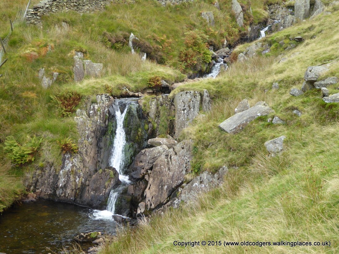
'Waterfalls on Long House Gill'

'Seathwaite church'
At the bridge over the Duddon we met a walker coming the other way clutching a copy of Maugham's guidebook for the NoEW. He was the first, and only, person we met on the trip who had heard of the NoEW and he was doing the walk in stages. He mentioned some difficulties ahead and suggested an alternative route. We parted wishing each other well for the remainder of our walks.
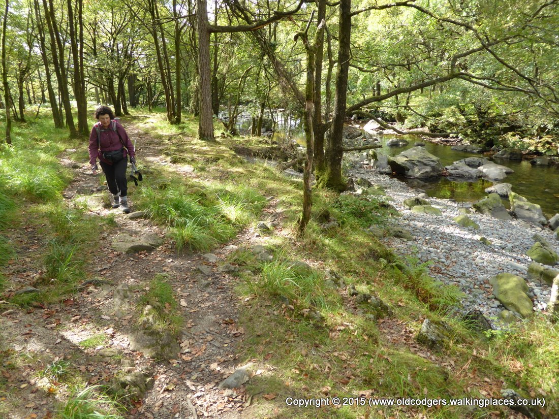
'Walking beside the Duddon'
Our second very steep climb of the day took us through a wood beside Rake Beck up the flank of Wallowbarrow Crag. We thought it was tough, but we had to reconsider when a couple of fell runners passed us at speed. Near the top of the Crag the small patches of heather were still blooming.

'Climbing beside Wallowbarrow Crag'
From the top of Wallowbarrow to Grassguards farm was a level easy mile of forestry and farm tracks. Part way along we stopped at a rock that served as picnic table for our lunch from the pub – sandwiches with thick slices of ham and mustard or even thicker slices of sharp, crumbly cheddar with pickles, and orange juice and apples. It was the equal best lunch of the walk (with the lunch from Moorlands B&B, Levisham). Apart from the food, we were able to appreciate a fantastic view of the Duddon valley and our route for part of the morning along the Walna Scar Road from the Pass down to Seathwaite. Being able to see a large section of the route just completed gives great satisfaction. Views ahead of a section to be completed, as we had seen from the Pass that morning, excite anticipation of the walk ahead.

'Lunch near Grassguards'

'The best sandwich'

'Looking over the morning's walk from Walna Scar pass down to Seathwaite'
We had arranged to meet friends from Brisbane, Robyn and David, at the Boot Inn between 4 and 5 that evening. They had planned to complete the C2C and then hire a car to come back to the Lakes to further explore areas associated with Roman occupation. Our paths were to coincide in the south-western Lakes. From our lunch spot we had 5 ½ miles to go. Our average moving speed on most days had been 3 mph, so we figured that 2 hours of solid walking, mostly downhill, should get us to Boot before 4.30pm.
Past Grassguards Farm the NoEW followed Grassguards Gill across what was shown in Maugham's guidebook as open fields. Since then a forest shown on the OS map had been planted. The forest had been clear-felled recently obliterating any walking paths. The track constructed to bring out the logs headed up the Gill in the right direction so we set off up the new track. The further we went, the more the track arced away from the NoEW route. We could see a point about a mile away where the adjoining forest finished and the NoEW emerged, so we set off across the felled forest. The going was impeded by a deep and uneven layer of debris that we sank into at every step, by sticks and logs that tripped us often, and by streams and bogs that we had to find ways around and across.

'Crossing the debris of the felled forest'
Eventually we reached the stone wall at the edge of the felled forest. Beside the wall were trampled paths left by other walkers trying to find a way out of the mire. We went through a gate that previous walkers had gone through to find we had half a mile of bog to traverse. Following the trampled grass tracks of previous walkers helped avoid some, but not all, of the bogs. We scaled a fence at the corner of the existing plantation to rejoin the 'correct' NoEW route below the peak of Harter Fell. The mile across felled forest and bogs had taken an hour.
A few months before our walk, we watched Tony Robinson's series 'Walking through history'. The episode on Roman sites in the Lakes (the inspiration for our friends' journey) included a view over Hardknott Fort that Graham had worked out was from Harter Fell. As we rounded the shoulder of Harter Fell, there was the view of the Fort. This was a highlight for the day.

'The view – Hardknott Roman Fort'
The 'correct' path across the shoulder of Harter Fell was rough and boggy. A new fence had been constructed and tracks had been left all over the place by the construction workers and their machinery. As we began the steep descent into the Esk valley the clear path passed a stile with no clear path on the other side. We continued along the clear path down the hill to find it blocked by the new fence. We retraced our steps back up the steep hill to cross the stile then zigzagged across several tracks to find a way down. When we came across tractor tracks that we assumed had been used to carry fencing materials up the ridge, we followed them down to the valley floor. Using the GPS we found we were further up the valley than the NoEW. Following farm tracks we rejoined the NoEW near Penny Hill Farm. After crossing the Esk over Doctor Bridge we followed the road to Boot, rather than following the NoEW across farmland, to save a few minutes.

'An Eskdale farm'
We met our friends in the beer garden of the Boot Inn at 5.30. We had a great evening swapping stories of our walks, congratulating Robyn and David on completing the C2C, sampling Cumbrian beers, watching the sun set down the steep-sided Esk valley from the conservatory dining area of the Inn, and having dinner.

'Boot Inn beergarden'